Launchpad: Government drone, data collectors

A roundup of recent products in the GNSS and inertial positioning industry from the November 2020 issue of GPS World magazine.
OEM
GNSS receiver
Sub-decimeter accuracy without additional service subscription
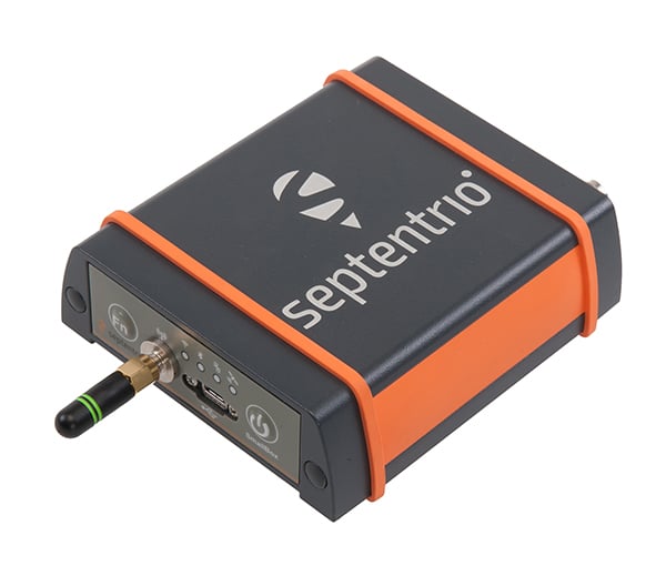
The AsteRs-m2-Sx. (Photo: Septentrio)
The SECORX-S product line, which first offered GNSS OEM boards, now also includes a compact mosaic-Sx module and ruggedized receiver in an IP68 chassis, the AsteRx SB Sx. The multi-constellation multi-frequency SECORX-S receivers deliver sub-decimeter positioning without the need for additional correction service subscription or maintenance. The PPP-RTK correction service is integrated directly into Septentrio’s core GNSS technology. The addition of modules and boxed receivers to the SECORX-S line providesz accurate positioning to applications such as precision agriculture, UAVs, robotics and construction.
Septentrio, septentrio.com
GNSS splitters
Improve service reliability
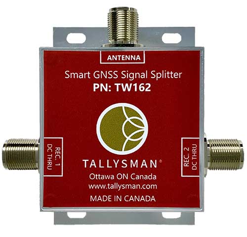
Photo: Tallysman
Smart Power GNSS signal splitters improve GNSS service reliability and minimize service interruptions. The professional-grade splitters — TW162 (one antenna/two receivers) and TW164 (one antenna/four receivers) — offer system redundancy and fail-over capability. The splitters are designed to improve GNSS service reliability and reduce signal reception failures. Both splitters offer system redundancy and fail-over capability. They support GPS/QZSS-L1/L2/L5, QZSS-L6, GLONASS-G1/G2/G3, Galileo-E1/E5a/E5b/E6, BeiDou-B1/B2/B2a/B3 and L-band correction services.
Tallysman, tallysman.com
5G modules
Ready for 5G platforms
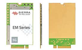
Photo: Sierra Wireless
The EM919x 5G NR Sub-6 GHz and mmWave embedded modules include an integrated GNSS receiver. Based on the industry-standard M.2 form factor, the modules will enable original equipment manufacturers (OEMs) to securely deploy 5G connectivity worldwide at the highest possible speeds with ultra-low latency for routers and gateways. The modules support mmWave, sub-6 GHz and LTE, as defined by the 3GPP Release 15 standard. Applications include private networks, enterprise networking, edge processing, live streaming, video security, e-gaming, smart factories, robotics, drones, virtual reality, machine learning, and new Industrial IoT applications.
Sierra Wireless, sierrawireless.com
GNSS/IMU series
Tactical-Grade Inertial Positioning
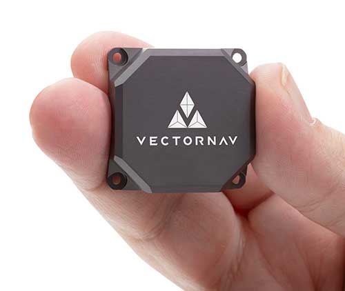
Tactical Embedded series of GNSS/IMUs. (Photo: VectorNav)
The Tactical Embedded series of GNSS/IMUs feature a tactical-grade inertial measurement unit (IMU) and a multi-band GNSS receiver. The line delivers milliradian attitude accuracy and centimeter-level positioning capability in a miniature 15-gram package. The small size enables cost reductions for a range of autonomous pointing and geo-referencing applications such as gimballed intelligence, surveillance and reconnaissance (ISR); satellite communication systems; lidar mapping; and photogrammetry. The line supports external SAASM GPS for defense applications in ISR, electronic warfare, munitions and UAV navigation. The line includes the VN-110E IMU/AHRS, the VN-210E GNSS-aided inertial navigation system (INS), and the VN-310E dual-antenna GNSS/INS.
VectorNav Technologies, vectornav.com
GNSS/INS Sensor
Designed for dynamic environments
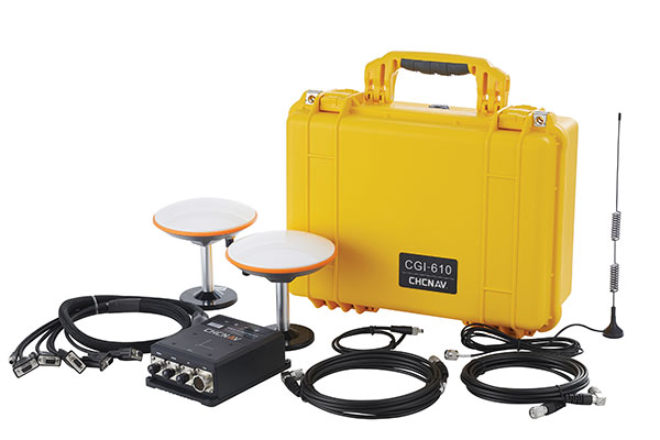
Photo: CHCNAV
The CGI-610 GNSS/INS high-precision dual-antenna receiver offers reliable and accurate navigation and positioning for demanding land, marine and aerial applications. The tight fusion of the latest GNSS technology with an industrial-grade MEMS IMU is powered by CHCNAV’s algorithms to deliver accurate hybrid position, attitude and velocity data, even in complex and obstructed environments where GNSS outages can occur. The CGI-610 supports data output up to 100 Hz to meet the requirements of highly dynamic applications such as airplane, train and automobile. An optional external odometer sensor for ground vehicles can provide an additional measurement of displacement and speed, which is fused with the GNSS/INS navigation solution.
CHC Navigation, chcnav.com
SURVEYING & MAPPING
GNSS receiver
Scalable-accuracy, survey-grade receiver
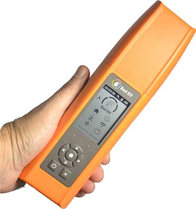
Photo: Bad Elf
Bad Elf Flex is a scalable-accuracy GNSS receiver with a daily option to choose between L-band and real-time kinematic (RTK). In standard configuration, it achieves 30-60 cm accuracy in real time for GIS use. Consuming a Bad Elf Flex Token unlocks a full RTK workflow for a 24-hour period to deliver 1-cm horizontal accuracy. Bad Elf Flex stores the tokens directly on the receiver, making them available for use anytime. Customers requiring high accuracy at all times can purchase the Bad Elf Flex Extreme bundle, with RTK capabilities permanently unlocked, for a one-time upgrade fee.
Bad Elf LLC, bad-elf.com
Data Collector
With integrated autofocusing camera

Photo: ComNav
The R550 data collector features an industrial-level design and new hardware platform to ensure efficiency and productivity in the field. The IP67 dust-and-waterproof rating protects the R550 from most harsh environments. Equipping it with a 7,000 mA Li-ion battery allows more than 14 hours of continuous operation, while fast-charging technology means four hours for a full charge. The 5-inch-wide sunlight-readable, high-resolution screen provides a smooth experience for any operation. The integrated autofocusing camera helps enhance job documentation by taking photos on site and sharing job information with colleagues. Survey Master field software available on the R550 controller ensures efficient surveys in the field, including topographic surveys, stakeouts, coordinate geometry (COGO) and more. Powered by the Android 8.1 operating system and designed with 4G RAM, 64GB ROM and 4G/BT/Wi-Fi on board, users can run other third-party apps based on their specific requirements.
ComNav Technology, www.comnavtech.com
UAV
OEM board
Provides georeferencing of airborne data

Photo: Applanix
The Trimble AP+ Air OEM solution provides direct georeferencing of airborne sensor data and enables users to accurately and efficiently produce maps and 3D models without the use of ground control points. It is designed for manned platforms, yet small enough for use on UAVs. It is also compatible with airborne remote sensors, including photogrammetric cameras, lidar, hyper- and multi-spectral cameras, and synthetic aperture radar. The Trimble AP+ Air features dual embedded survey-grade GNSS chipsets, an onboard inertial measurement unit (IMU), an external IMU, and the new Applanix IN-Fusion+ GNSS-aided inertial firmware. It is configurable to support the direct georeferencing accuracy demands of low-flying UAVs and high-altitude manned platforms. Trimble AP+ Air is supported by Applanix POSPac MMS post-processing software with CenterPoint RTX post-processing for centimeter-level positioning anywhere in the world without the need for base stations.
Applanix, applanix.com
Drone for Government
American-made drone aimed at government agencies and military

Photo: Teal
The Teal Golden Eagle drone is designed for short-range surveillance and reconnaissance missions. It features a FLIR Handron dual-camera sensor on a two-axis stabilizer, giving it color vision at 4K 60 fps and thermal vision for extended operations. The payload is hot-swappable. It has a flight time of up to 50 minutes and can fly at speeds of 50 mph with a range of 2 miles. It is able to fly in wind speeds of up to 30 mph and can operate between –32° and 110° Fahrenheit. Forward-facing obstacle avoidance and rear-facing visual-inertial odometry estimates location without the need for GPS. The platform has received approval from the Department of Defense.
Teal, tealdrones.com
TRANSPORTATION
Antennas
Aimed at autonomous vehicle market
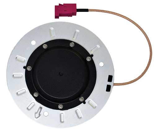
Photo: Tallysman
A new line of AccuAuto triple-band antennas are designed to provide strong clean code and phase signals to enable high-precision real-time kinematic (RTK) and precise point positioning (PPP) navigation. Model TWA928 supports GPS/QZSS-L1/L2/L5, GLONASS-G1/G2/G3, Galileo-E1/E5a/E5b, BeiDou-B1/B2/B2a and NavIC-L5 signals and frequency bands (the TWA928L includes support for L-band correction services). The AccuAuto line features patented Accutenna technology multi-constellation and multi-frequency antenna elements as well as an integrated ground plane, a radome and an underside cover that provides mist and condensation protection. A deep pre-filter minimizes out-of-band noise and maximizes in-band reception. All AccuAuto components are certified and designed to perform under challenging environmental conditions, such as extreme temperatures (–40° C to +125° C), shock and vibration.
Tallysman Wireless, tallysman.com
Navigation system
Defense small-vehicle system designed for export
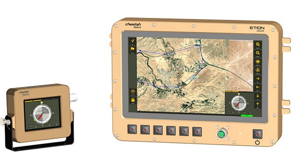
Photo: Etion Create
The CheetahNAV provides situational awareness for harsh environments and battlefield conditions, providing the crew of a light military vehicle with highly accurate position information through an advanced inertial measurement system (IMS) comprising several aids, including a gyro-compensated compass and an advanced Kalman-filter-based algorithm. The system provides dead-reckoning horizontal position accuracy of 0.2% of distance traveled in a GNSS-denied situation — accuracy of 200 meters over 100 kilometers. It can integrate with inertial navigation systems (INS). Combined with GNSS and compass information, the system enables dead-reckoning and accurate positioning of the vehicle in tactical situations. The tactical-grade integral inertial measurement unit (IMU) ensures jam-free operation.
Etion Create, etion.co.za/create/


About the Author: Tracy Cozzens
Senior Editor Tracy Cozzens joined GPS World magazine in 2006. She also is editor of GPS World’s newsletters and the sister website Geospatial Solutions. She has worked in government, for non-profits, and in corporate communications, editing a variety of publications for audiences ranging from federal government contractors to teachers.


Subscribe to GPS World
If you enjoyed this article, subscribe to GPS World to receive more articles just like it.


Follow Us