Diving into UAV lidar surveys
March 29, 2021
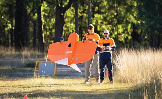
The worlds of UAVs, lidar and surveying overlap, with UAV-based lidar able to shed light on places that […]
Read More
The worlds of UAVs, lidar and surveying overlap, with UAV-based lidar able to shed light on places that […]

The collection of about 300 giant geoglyphs known as Nasca Lines were etched into the ground in the […]
Earlier this year, a drone pilot and two data scientists from PrecisionHawk traveled to the Philippines for a […]

Uplift adds commercially trained pilots and expands PrecisionHawk’s industry expertise and relationships in drone-based services for construction and […]

New risk-based “bow-tie” zones will help protect aircraft using PrecisionHawk’s Low Altitude Traffic and Airspace Safety (LATAS) platform. […]
Drone company PrecisionHawk has announced a partnership with EagleView, a provider of aerial imagery and data analytics for […]

PrecisionHawk’s Matt Coleman gives GPS World an overview of the company’s end-to-end product offerings, which include the PrecisionMapper […]

Insitu and PrecisionHawk have formed a strategic alliance to provide UAS solutions that help commercial enterprises achieve safe unmanned flight for extended and beyond-visual-line-of-sight […]


Follow Us